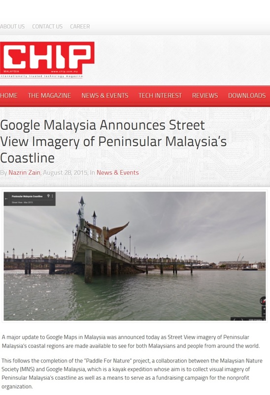
Paddle for Nature Imagery of Coastline Available on Google Street View
VISUALS taken by the Malaysian Nature Society (MNS) marine conservation project, Paddle for Nature, is now available for viewing on Google Maps under the Street View platform. Launched on 28th August 2015 at the Google Malaysia office, the Street View Coastline Imagery was captured during Paddle for Nature’s six-month journey from Kelantan to Langkawi in a kayak equipped with the Google Street View Trekker.
Managing Director, Google Malaysia, Vietnam, Philippines and Emerging Markets, Sajith Sivanandan, said the update to Google Maps’ Street View Imagery of Malaysia shows the Peninsular Malaysia coastline taken by MNS volunteers using Google Street View technology, which he emphasised was “literally the first of its kind in the world for Street View”.
Managing Director, Google Malaysia, Vietnam, Philippines and Emerging Markets, Sajith Sivanandan, said the update to Google Maps’ Street View Imagery of Malaysia shows the Peninsular Malaysia coastline taken by MNS volunteers using Google Street View technology, which he emphasised was “literally the first of its kind in the world for Street View”.
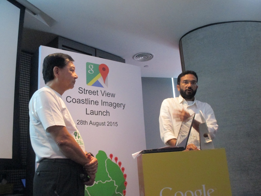
MNS President Henry Goh with Google Country MD Sajith Sivanandan at the launch of the Street View Coastline Imagery, as seen below
|
He said Google Malaysia’s support of MNS’s mission to collect baseline visuals of the coast, create awareness of the country’s ocean heritage and highlight “local heroes” helping to protect these treasures, complemented its vision of collecting and organising information.
Paddle for Nature started in Pengkalan Kubor, Kelantan on 9th September 2014 and finished in Kuah, Langkawi on 12 March 2015, taking in almost all of the peninsula’s 2,000km coastline and more essentially, ecologically sensitive areas, such as Setiu Wetlands, Merambong seagrass area, Important Bird Areas (IBAs) in Johor, Port Dickson and Kuala Selangor, mangrove areas in Pulau Kukup and Larut Matang, Penang National Park and the Unesco-recognised Langkawi Geopark. Meanwhile, MNS President Henry Goh said Paddle for Nature has been beneficial in raising awareness about Malaysia’s marine heritage – “our wetlands, seas and everything that survives within and on our coastal waters – and why it is essential that we protect it”. Google Malaysia was instrumental in expanding that awareness by providing the Street View Trekker during the journey, Goh said, and now even more so by making these images available for the world to see. “Because beyond the entertainment and tourism value, these Street View images of the coastline and some of our islands can greatly assist the authorities in identifying threats, especially in inaccessible areas, and provide them with valuable data that will help in the management of our fragile coastline.” |
Goh also announced that MNS will continue its marine conservation efforts in the future, with an open sea crossing, from Tioman to the mainland, to highlight MNS’s Tioman projects, Restore Our Awesome Reefs (ROAR) on the marine environment and Revisiting Our Original TreeS (ROOTS) on the protected coastal forest. Aside from that, MNS hopes to make Paddle for Nature its signatory event for marine conservation, where many more volunteers can be involved in creating awareness about the importance of Malaysia’s marine heritage and the need to protect it.
“In the future, we envision Paddle for Nature events being run by volunteers or communities in their own areas and involving the local population, therefore getting more people involved. It might even be set on a particular date, so that Malaysians around the country can get together with local MNS branches and do something for Mother Nature together,” he said.
“In the future, we envision Paddle for Nature events being run by volunteers or communities in their own areas and involving the local population, therefore getting more people involved. It might even be set on a particular date, so that Malaysians around the country can get together with local MNS branches and do something for Mother Nature together,” he said.
|
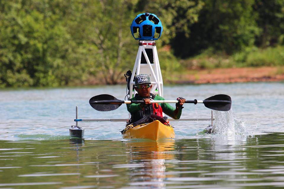
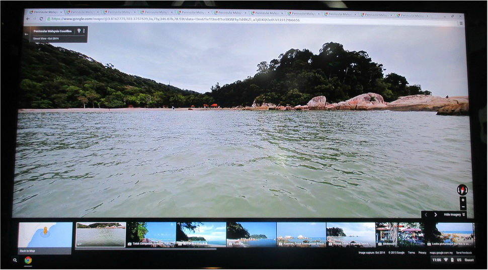
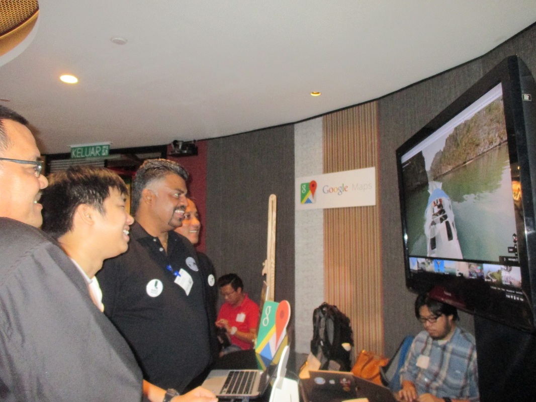
At left, the MNS team views some of the imagery captured by Paddle for Nature as the volunteer kayakers (Ajai, above) paddled around Peninsular Malaysia
|