
Saving Nature one stroke at a time
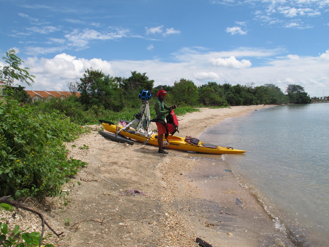
The idea is simple. Paddle a kayak along the Peninsular Malaysia coastline, collating data on the conditions and, along the way, raising awareness about our marine heritage and the need to protect it. Of course, executing it has not been that easy. It took almost a year from the initial discussion for the project to be finalised. And when Google offered their support, Paddle For Nature really got into its groove with the addition of the Google Street View Trekker to track the true conditions of the coastline.
With paddler Hari Raju , the journey started on 9th September 2014 from Pengkalan Kubor, Kelantan, and he completed some 500km to Pekan, Pahang. In Phase 2, Paddle for Nature migrated to relay kayaking and the journey continued from Johor to the final destination in Langkawi, covering some 1,000km. Our main paddler was Che Zahiruddin Che Othman, popularly known as Ajai, who was only 19 when he took over the reins.
Thanks to the help of volunteers among MNS members and KPA for Youth participants, we successfully completed a journey that has been gruelling but satisfying, to raise awareness about Malaysia's marine heritage and the need to protect it.
|
The issues
A total of 70% of the planet’s surface is covered by the sea, which makes the ocean mankind’s biggest ecosystem and food source. However, the degradation to the coastal ecosystems and ocean resources is alarming. Being the sink for everything from greenhouse gasses to plastic bottles and baby diapers, the ocean and marine ecosystem are seriously under threat. Land use changes are easily visible to the public eye. Not so obvious to the majority of the people, however, is the fact that as Malaysia is a coastal country, its most urbanised and developed areas are along the coastal zones. About 2,000km of the peninsula’s coastline has changed rapidly within the past 10 years and more land conversions are being planned. |
|
MNS therefore organised the kayak expedition as a means of documenting and highlighting our coastal landscape and the importance of protecting our coastal resources, and articulating this information to the public, especially our leaders and the younger generation.
The objectives
1) To collate baseline data on current land use along the coast of Peninsular Malaysia;
2) To gain public attention and raise awareness on our marine and coastal resources;
3) To promote conservation initiative by coastal communities;
4) To publicise MNS’s conservation efforts;
5) To raise funds for MNS’s conservation programmes.
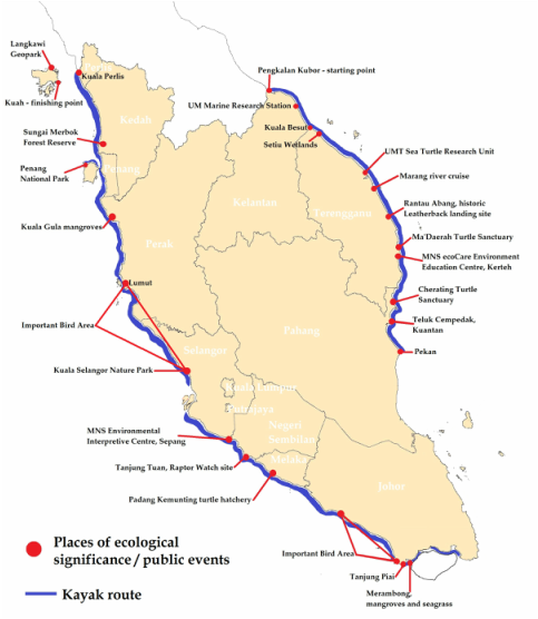
An eye on our 2,000km coastline
|
The route begins at Kelantan’s border with Thailand through to the border in Perlis, taking in some of our islands, and officially ending in Langkawi. The aim is to collect data and observation of the coastline of the peninsula, with official stops and myriad events along the way.
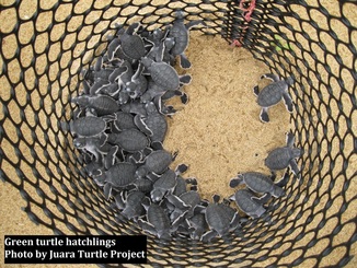
With the support of Google through its Street View Trekker, geotagged photographs are taken for baseline documentation of the current land use along Peninsular Malaysia’s coast. This will help record the actual threat faced by our coastline habitat and assist the relevant authorities in their local management and development plan. The expedition also visits several environmentally significant areas to create more awareness about their importance, while highlighting the "local heroes" who make the effort of ensuring a greener world. The areas include research centres, turtle landing sites/hatcheries, Marine Parks, Important Mangrove Sites, seagrass beds, Important Bird Areas, State Parks, recreational beaches, wildlife reserves and Geopark/World Heritage Site. |
Communication, Education, Participation and Awareness (CEPA) are the key words for today’s success stories in conservation, and as such, events are held at several stops to share issues, experience and also learn from local communities and schools. Special talks on the paddling experience as well as conservation and nature-based activities are conducted along with MNS Branch members.
